

2026 Guerrero Earthquake
M6.5 subduction zone earthquake near Acapulco, Mexico claimed two lives.

On January 2, 2026 at 7:58 am local time, a magnitude 6.5 earthquake struck in the Mexican state of Guerrero, northeast of the city of Acapulco. Two people were killed, seventeen others injured, and hundreds of buildings were damaged or destroyed.
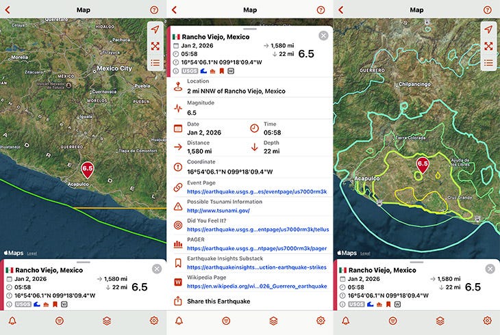
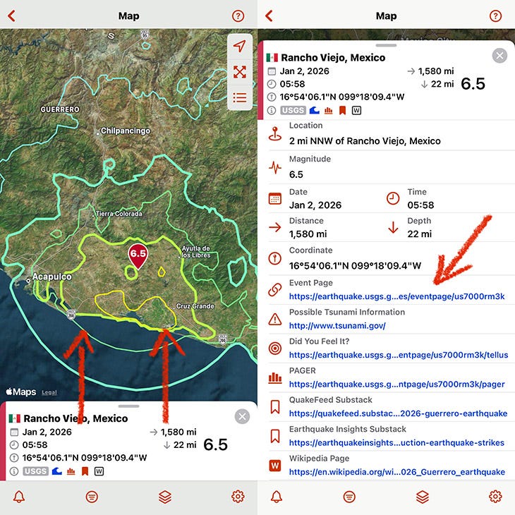
QuakeFeed screens showing the epicenter, earthquake details, and shaking intensity for the 2026 Guerrero Earthquake.
Basic Facts
Location: Southwest Mexico in the state of Guerrero near the town of San Marcos
Date & Time: 2 January 2026, 7:58 local time (13:58 UTC)
Magnitude: 6.5 Mw
Depth: 22 miles / 35 km
Fault System: Middle America Trench subduction zone (megathrust fault)
Maximum Intensity: VI (Strong) on the Modified Mercali Intensity Scale
Felt Area: Guerrero, Morelos and Mexico City, Mexico
Tectonic Setting: Middle America Trench, where the Cocos Plate subducts beneath the North American Plate
Impact Summary
The city of San Marcos, nine miles south of the epicenter, suffered the most damage. More than 700 homes were damaged and an estimated 70 collapsed. One woman died there when her home collapsed on her.
Shaking was felt as far as Mexico City, approximately 170 miles to the north, where one man died after falling down stairs while evacuating a building. Mexico's capital city was built atop soft, ancient lakebed sediments that amplify seismic waves, making distant earthquakes feel more intense than their distance would suggest.
The earthquake also interrupted Mexican President Claudia Sheinbaum's news conference. Video footage showed people calmly evacuating the building.
Get the QuakeFeed App
Curious about earthquakes? Download QuakeFeed from the iOS App Store to explore thousands of earthquake events on an interactive map. Activate the 30-day Free Trial for QuakeFeed Premium to enable more features — MMI contours, volcanoes, historical earthquakes, and more.
View Earthquake Details in QuakeFeed
When you see small icons in the earthquake list like the ones circled in green below, that indicates there are links to in-depth information on the earthquake details screen. We recently wrote a substack article explaining what these icons mean.
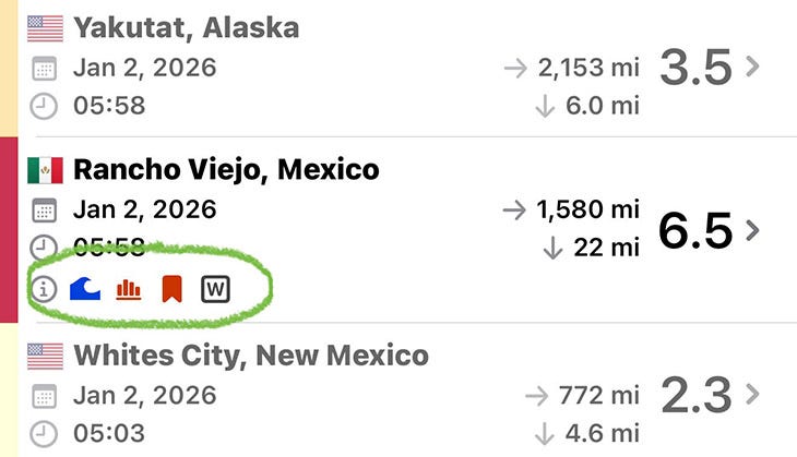
Tap on the earthquake in the list to view the details screen, then pull up on the info panel at the bottom of the screen to access the links.
Continue Learning
USGS: M 6.5 - 4 km NNW of Rancho Viejo, Mexico
Earthquake Insights: M6.5 subduction earthquake strikes near Acapulco, Mexico
Wikipedia: 2026 Guerrero Earthquake